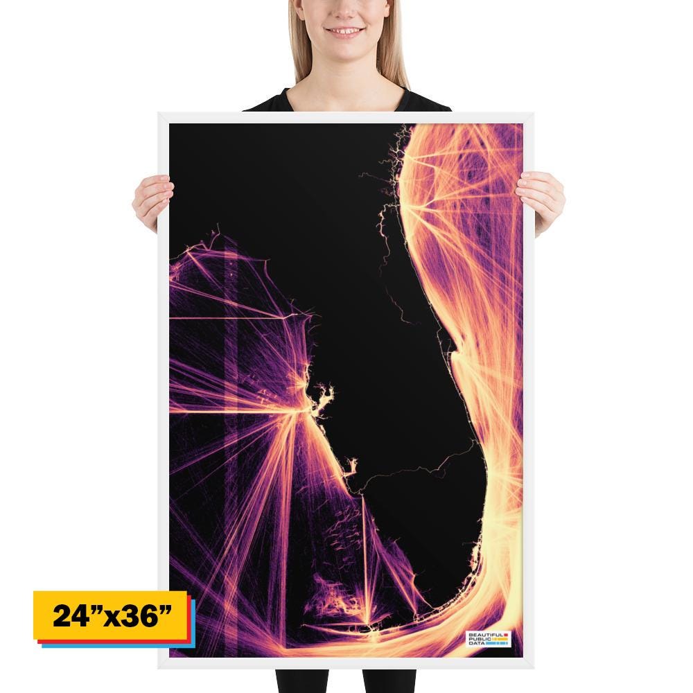
Every glowing line is a real ship. This is one full year of vessel traffic along the Florida coast — Tampa Bay, the Keys, Miami, Fort Lauderdale, Jacksonville, and the Gulf shipping lanes — built from public AIS tracking data. The state outline emerges entirely from where ships go.
Beautiful Public Data logo, bottom right.
This map features: Florida
Read more about this visualization: https://www.beautifulpublicdata.com/visualizing-ship-movements-with-ais-data/
• Ayous wood .75″ (1.9 cm) thick frame from renewable forests
• Paper thickness: 10.3 mil (0.26 mm)
• Paper weight: 189 g/m²
• Lightweight
• Acrylite front protector
• Hanging hardware included
• Blank product components in the US sourced from Japan and the US
• Blank product components in the EU sourced from Japan and Latvia
How to attach hooks on 24″ × 36″ horizontal frames:
Place each of the mounting hooks 1 inch (2.5 cm) from frame corners when hanging horizontally.